

DRONE SERVICES
What We Offer:
❋ Drone Photography❋ Construction & Site Progress Documentation❋ Inspection & SurveysOur drone services provide high-resolution aerial imagery for residential properties, commercial sites, and development projects. Aerial photography is widely used in property marketing to showcase homes, land, and surrounding areas from perspectives that cannot be captured from the ground, helping listings stand out and giving buyers a clearer sense of location and scale. In addition to property photography, drone services can also be used for site documentation, construction progress tracking, and visual inspections of buildings and structures where safe access is limited.

Drone Photography
Drone photography provides a unique perspective that enhances residential property marketing by showcasing homes, land, and surrounding areas from the air. Aerial images help highlight property boundaries, garden space, nearby features, and the overall setting, giving potential buyers a clearer understanding of the property and its location. This added perspective helps listings stand out and presents properties in a more complete and visually engaging way.
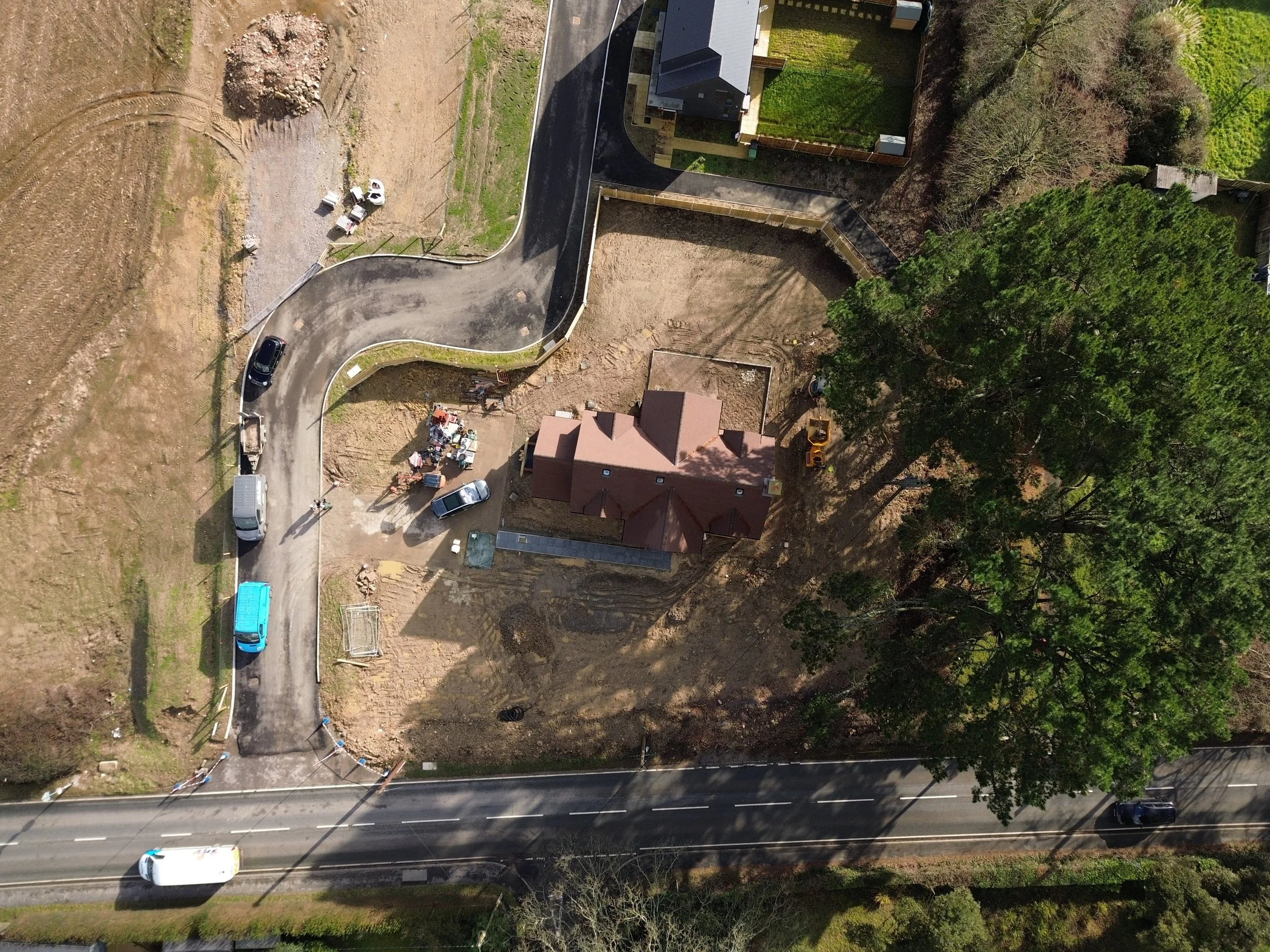
Construction & Site Progress Documentation
Drone imagery can be used to document construction sites and track progress throughout a project. Regular aerial captures provide a clear overview of site activity, development stages, and changes over time, creating a visual record that can be shared with stakeholders, clients, and project teams. This type of documentation helps keep projects transparent and provides an efficient way to monitor progress without disrupting on-site operations.
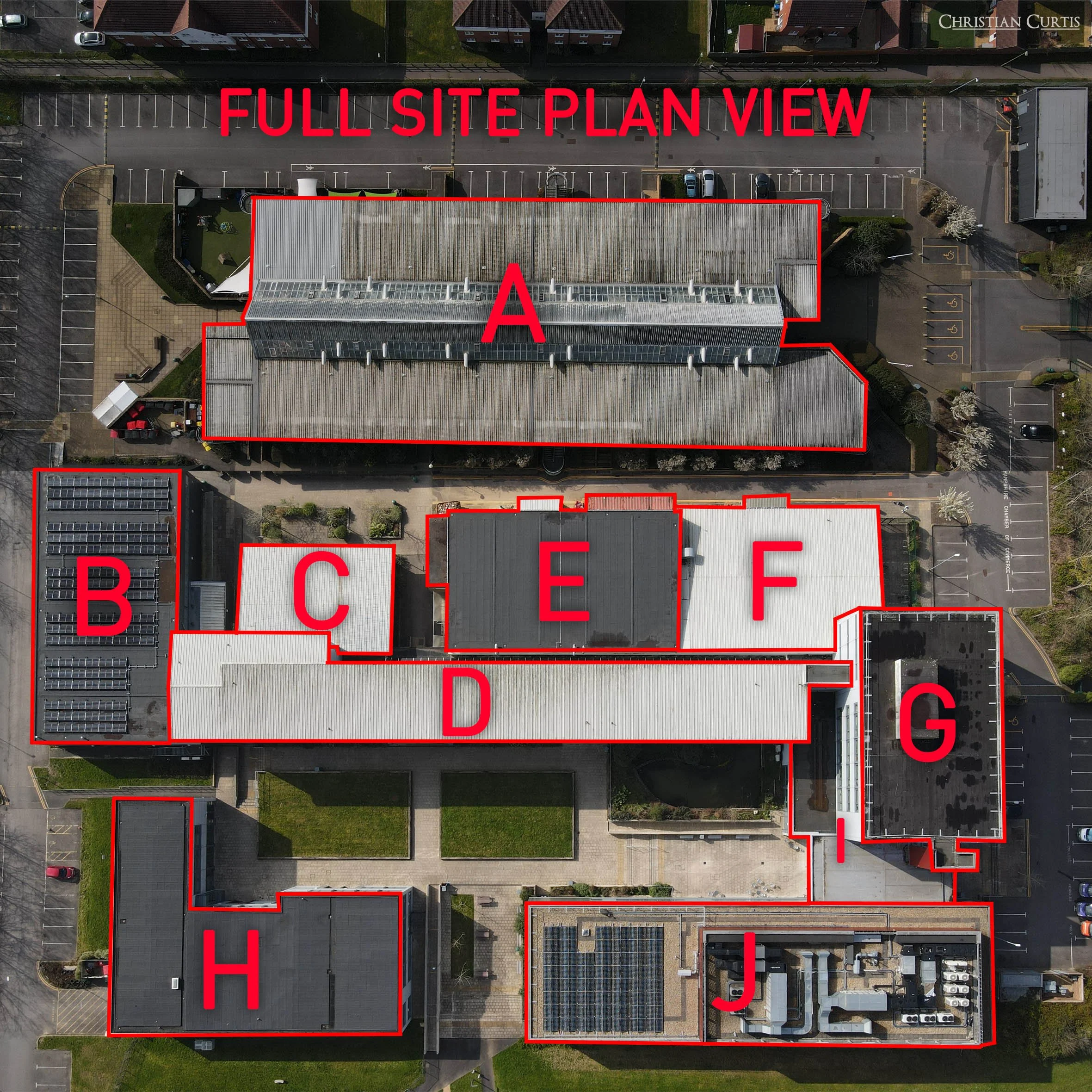
Inspections & Surveys
Drone inspections provide a safe and efficient way to capture detailed imagery of roofs, structures, and hard-to-reach areas without the need for scaffolding or manual access. High-resolution aerial images allow contractors and property owners to visually assess potential damage, wear, or problem areas while maintaining a clear record of the structure’s condition. This approach reduces inspection time and improves accessibility while providing accurate visual information for maintenance and assessment.
We’ve worked with contractors to provide drone inspections and surveys for large commercial factories, as well as a roof inspection for Fareham College where we created a site map, and provided a detailed summary of the areas of concern each building.
Get In Touch
If you require aerial photography, site documentation, or drone inspection services, get in touch to discuss your project. Each site and property has different requirements, and we can provide a tailored approach based on the scale, location, and purpose of the work. Contact us today to learn more about how drone services can support your property or project.